Super Typhoon Dolphin 2026
RESULT: Typhoon Dolphin made landfall near Yuhuan, Zhejiang province, China on August 9, 2026 (~17:30 local), with sustained winds ~151 km/h, China's strongest storm of 2026. 1M+ people evacuated; 943 Shanghai airport flights cancelled; severe flooding across Zhejiang and Shanghai. Sources: CNBC, Al Jazeera, NBC News.
The context
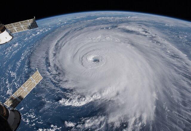
RESULT, August 9, 2026: Super Typhoon Dolphin made landfall near Yuhuan, Zhejiang province, eastern China at approximately 17:30 local time, with sustained winds of around 151 km/h. The storm tracked toward China’s coast rather than Japan as originally forecast, a significant shift that meant Chinese authorities mobilised over 1 million evacuations while the Japanese threat receded. It was China’s strongest typhoon of 2026.
The storm had been one of the fastest-intensifying Pacific typhoons in recent years, briefly reaching near 240-305 km/h over open ocean before weakening as it approached the coast. Landfall in Zhejiang was nevertheless destructive. In Taizhou, approximately 390,000 people were displaced; Shanghai ordered more than 30,000 additional evacuations. The city’s two airports, Pudong and Hongqiao, cancelled 943 flights, cutting capacity by some 40%, while streets across multiple Shanghai districts flooded under relentless rain. Zhejiang’s hardest-hit areas recorded an estimated 250-500 mm of precipitation over the storm’s passage.
The contrast with the original Japan-forecast scenario was stark. Early models from late July had pointed toward a Kyushu or Honshu landfall on August 5-7, and Japan’s Meteorological Agency had been on alert. As August arrived, models progressively shifted the track westward; by August 8 a China landfall was the dominant scenario. Japan received peripheral rainfall but no direct hit. Sources: CNBC, Al Jazeera, NBC News, AccuWeather, JTWC.